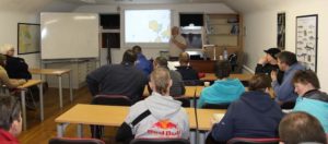
The Sub Aqua Club in Athlone once again proved an ideal location for a CSIG presentation to the local RNLI Lough Ree Station volunteers on February 22nd. The event was well supported with 22 people in attendance to listen to Pat McManus, the CSIG’s Lough Ree expert, talk about what the CSIG had achieved on the lake to date, and what it hoped to achieve in the future. Pat’s presentation included a number of images and charts from the work of the past year, and included a chart with a longitude and latitude grid on it –a CSIG first and one especially constructed for the evening by CSIG mappers at the request of the RNLI.
The evening was a great success, and the RNLI expressed an intention to continue to work with Pat, with a long-term goal of breaking the lake into charts of six separate ‘operational zones’ and a number of smaller pilot charts.
Liam Sheringham of Lough Ree RNLI wrote thanking Pat for an excellent and very informative presentation. He stated “Your charts, especially the small pilot charts, are excellent and will be invaluable to our lifeboat for navigating off the main channel. I will be meeting with our crew soon to discuss what we exactly need in terms of dividing the lake into 6 operational zones with bearing and leading lines and a lat/long grid!”
© G Byford
